

THE GHOST OF AN IDEA
WRITTEN BY Hayley Flynn
READING TIME: 3 minutes
At various points along Oxford Road, the education mile, you can find recesses at first floor level that were intended, one day, to be the connecting points of pedestrian walkways.

The RNCM originally incorporated the walkways, Manchester Education Precinct Review, 1974
Pedestrians were to be put up in the air with a system of interconnecting overhead walkways linking the main buildings with their entrances at first-floor level. Oxford Road, effectively, was a road atop a set of concrete stilts.
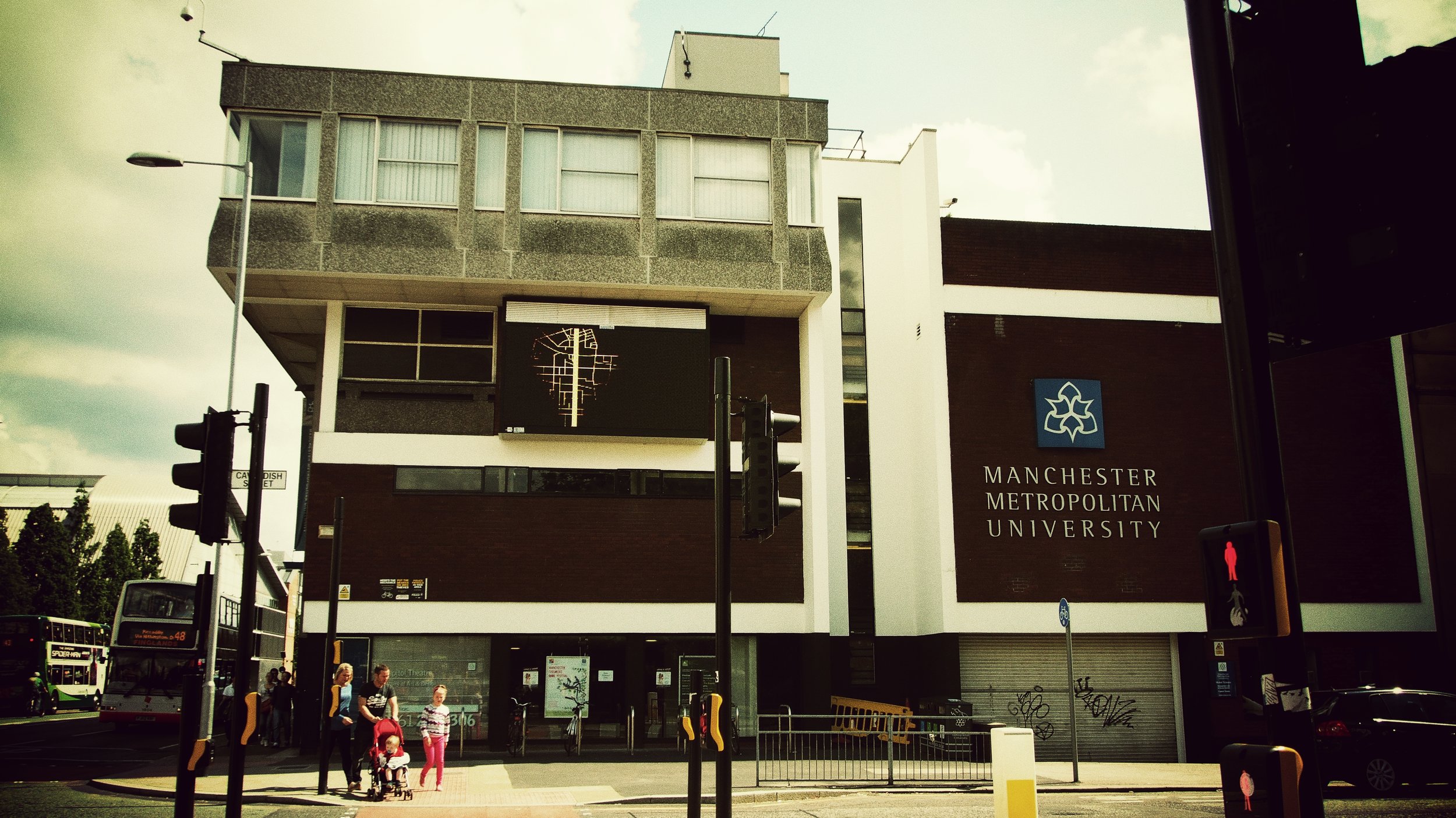
The image below is part of the MMU at the corner of Oxford Road and Cavendish. What was once intended to be a walkway from here to neighbouring buildings is now a rather ugly looking, boarded-up, dead end. An earlier image of the same building show the walkway unboarded (but unconnected) with a car entering the ground floor level. This was taken in 1974.
The walkway notion didn’t completely fall flat on its face as upper-level commercial ventures and some existing paths are still to be found above the street level; the precinct and walkway at the Kilburn Building and the chapel for example where still in use unti demolition in 2017. Although this one, in particular, was a revival on the 1960s plans and not an original installation.
Black boarded-up remnants of the walkway (building demolished 2018)

Care of Manchester Libraries
Some walkways, such as one that connected the Precinct block to the Royal Northern College of Music, have come and gone, with this particular one surviving 30 years, albeit of disuse, up until the front of the RNCM was recently rebuilt. The old connection recesses were still easy to spot until the area was largely demolished in 2017/18, and there are other first level dead ends to be found down Oxford Road; for example, a recess at the Humanities Building, just behind the Museum Cafe, which has removable panels.
Post-war cities drew up modern plans to revitalise and renew their central zones and so it was that Manchester created The 1945 Plan. Swaths of wide roads and bold modernist buildings were to characterise the new Manchester, with a huge boulevard running up to Albert Square from Deansgate. The original 1945 plan is a great read and has been digitised so you can check it out below.
For one reason or another The 1945 Plan didn’t materialise but fresh ideas were always in the pipeline and after a plan drawn up in the early 60s by Cruickshank and Seward failed to fully materialise, it was in 1967 that a design concept was drawn up by local architects, Wilson and Wormersely, for a precinct walkway on Oxford Road. This plan failed due to economics and in the failing of this plan we perhaps avoided some sticky social situations as a consequence.
There are successful upper-level ventures; High Line in Manhattan has reclaimed a 1.5 mile stretch of elevated railroads for community parks and it’s a wonderful project but it’s not quite comparable to enclosed pedestrian pathways. Rather than remove the fear and stress of the busy roads below we potentially face a huge problem with crime.
For an example of how elevated walkways can turn sour, we only have to look toward the iconic Hulme Crescents. With no legal requirements to patrol the passageways connecting the residential blocks, it was here that crime found a perfect home. It was something of an urban planning disaster, although like many of the purpose-built council blocks of the time it was initially seen as revolutionary, cost-effective and fine modern living - the idealism soon wore off.
"A series of eight-storey semi-circular tower blocks linked by walkways. It was a robber’s paradise. I used to regularly visit people who lived there and the thieves were really polite. They used to push notes under the door asking people to please leave their valuables outside to minimise the damage of a break-in. They did as well!"
The mystery in all of the 1967 plans is in the form of the Mancunian Way. Why an inner-city motorway was erected at the proposed pedestrian level during the planning period is quite baffling but the road went on to win the 1968 Concrete Society Award and who’s to argue with that.
In doing some research for the piece I found this quote to illustrate how commonplace crime became.
The Crescents, their famous residents and some wonderful photographs and historical accounts can be found here